The projects and ideas I have altered and helped by you

This blog is designed to give the viewer more to do than just read, look and comment. I have made it so that you can comment and help me with my projects and influence and help realize my ideas. Do not be shy come on and help me create a mini world
Showing posts with label maps. Show all posts

Saturday, June 15, 2013

expanding Oronegro and an unexpected colony

Well as soon as I put it to a map Oronegro had to be bigger. after that first initial map I made a larger one, which required me to cut and paste mountain ranges to hide an unwanted area of coast line. but Now perhaps I shall do it all again! Oronegro is set to expand if there is the story to go with it!
what is currently is like!
As you can see from the picture above I left ample room to expand down the coasts to the south, along the coast to the north and perhaps west (the Pan Andean Peoples Republic could be encircled by Oronegro.... a tribal group or groups that split and joined the republic when it formed.

To the south the land will get dryer becoming a desert away from the coast and rivers. a harsh landscape but also full of the valuable Oronegro the oil that keeps the nation strong! To the west it would get more mountainous and harder to access and to the east similar to the west but with sea on one side exposing the coastal area to violent storms (no doubt brought about by the energy created by the portals near by presence).
needless to say, this, my first map was too small for a land that just kept getting bigger in my mind

Ideas would be nice for these areas, but still tropical and warm (though the desert will just be plain hot and dry) is the main climate. perhaps snow and high winds on the mountains separating Oronegro from her northern neighbours. this would require them to be massive given the assumed location on the globe to allow cold enough temperatures but the climatic difference at at altitude is also a by product of the portal.
let us not forget this island! this is off the coast of Oronegro at some point.

All this extra land will be excellent for the 18th century arm and the 12st century arm of the Oronegrean story with the conquest of these lands and with the tale of the civil war respectively.

Now we come to the Colony! Why does Oronegro have a colony you ask.... let me explain. when I started making Oronegro in the 18th century I started to realise as I went on how powerful a nation that large in those times would be once it reached the 21st century! The United States of America was like Oronegro born out of a colony (well 13) which in the early 18th century had a population of roughly 1 million people! Now Oronegro might not have received so many immigrants since that time, why it is not even close to being as powerful. BUT! it would still have attained some power. enough to cause the Spanish to invade in the 1860's to assert their control on what was sort of (read the story) a colony.

Now where would a colony colonise? well the USA spread across a continent and then into the Pacific... Oronegro can't really go west (there are really high mountains and jungle that way) so it must go east! across the Neo-Atlantic Ocean...
... in other words the Oronegreans sailed around the portal (no mean feat as it is huge) and went to see what lay beyond! I will make a story... I like the idea the land was found by accident an Oronegrean merchant (not the brightest) who tried to go straight from some port in the desert region to Europe (instead of going north along the coast then east) and came across what to many would have seemed impossible eastern Europe...
what a strange place this is Carlos? aye captain they don't appear to speak Spanish at all. Do you think I may have gone to far south? aye captain I think you may have.

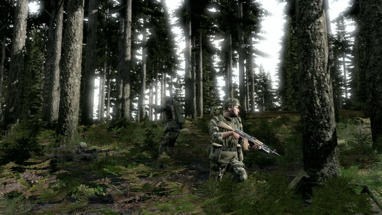
... Now this might sound mad and it is, But its useful as it answers some questions! a) how the Soviets got involved in South America to the extent they had whole armies there and b) what would happen if you missed the portal going the other way (going to and missing results in you visiting South America). Now the Next big question is why gowan did you do that? the answer is blame computer games!!!!!!!!!!!!! thanks to Arma 2 I have been playing around in both desert and former soviet block style lands! Fun but not so great for building inspiration for a Latin nation.
its the games fault not mine!
Anyway I have decided to have a colony here also! But Now I can have some real fun! basically I have 3 main types of environment.
  1. Hot desert, great climate for camels not so great for people who are lost. nasty giant gold mining ants! Which are actually described in the worlds first history/nonsense book... which I have read. thank you Herodotus!
  2. the Jungle and Tropical area, nice for relaxing by the beach  but seeming that some of my plans involve monsters in the jungle I don't think anyone should try and impersonate bear grills here at night.
  3. cold eastern European. snowy in winter (could even see some fun icescating... or what about Oronegrean ski tours... have fun on both dune and slope.) and pretty average in the summer. beware the bears and wolfs and you should be fine. just so long as its not the Russian bear in the woods some common sense and avoiding bear tracks should do you fine.

this is a cool vehicle! no other desciption needed... off topic but its the games fault for all this expansion eastards
Naturally the concept needs development! Naturally a map is needed. but apart from that this could be quite fun. it also begs the question who is connected to whom in this world but that's not important but the most fun part is surely that if I ever meet up with any of you we can play a game. Oronegrean support for US soldiers fighting the Soviet Union as it advances westward after the Re-union possible especially if the colony was at risk.

a very different landscape would exist in the colony... yes I have used lots of pictures form the game.
have fun guys! give me your ideas also.... think it would be cool to have a James Bond style bad guy layer in the Colony just say so. A link to Area 51 in the desert area (why area 51 might be such a secret) just say. ideas for a language for the colony why not. Just mention it because that's where I need help the most now.

greetings to my new followers! hello to fogsoldiers from fogsoldiers nice to have you on board. Welcome to Mike from mikes wargame blog thanks for joining.

Monday, August 27, 2012

Map tutorial.

I am pretty sure I may have posted this else where but this time it has pictures!!! I am now going to show you how to produce your own maps, I'll do this by creating La Isla del fuego! the island of fire that is just off the coast of Oronegro.

1. first up go to google maps
just take a look around for a place to be the setting!
2. Find a place to be the base of the map, Then turn on the terrain setting! Use the snipping tool that comes with Windows 7 to grab the desired image.
this island is just north of the philipeans for those of you who might want to use it ;-)
3. now lets get edditing. load the image into microsoft paint or a similar program, then we can edit it.
it might be a good idea to resize the image to get a better map, or a larger one.
4. now add some towns, I've not put a lot of thought into this because it is just an example
well not all we need is some labels, and possbily a scale!
5. add a key. a scale would be useful but as this is not key to a map of a fantasy land it need not be made!
add the final touches to your map and your done!!!!
Hope that helps you all! I might use this island in part of the Oronegro story but feel free to use it for your own Latin wars game if you want.

Monday, August 20, 2012

the maps of Oronegro!

Well I have now got 3 maps, thats right 3. One for the whole of Oronegro which is almost done. one of the Eastern costal side and one of La Ley! All of these I hope will give this small nation some realism that is needs. So what am I waiting for? come on take a look!
the east of Oronegro is the most populated area. I wish to do some changes to the Key! instead of forts it should be; military bases and training grounds

La Ley the grand Capital, now for you to see in it's full glory! This map took less time than Expected. perhaps you can say where you want your houses

And the whole nation itself. note the Nations beside it! Orotinia, Gran Bolivia and the Pan Andean peoples republic, these nations are those made by the great Archduce Picolo (ion I think?) I hope ion that you approve of their placing.
A few things yet to do but on the whole this nation is now mapped out! the southern end of the Oronegrean vally was made up with a colage of different hills, as in real life the area that forms this part of Oronegro is sea. anyway hope you like it. A few more places would be good and a key here and there but on the whole these are done!

hello to my latest follower Sander from Mon cher Alava, Marmont est perdu! , Modus Reg Magni Momenti and Mulvandania. nice for you to join the group!

Friday, June 1, 2012

more work on the map,,,

well here we go a bit more progress and I have made it bigger, given it a key and also added a new feature... forts/ millitary bases :-)
take a good look everybody
have a nice queens birthday weekend to all my Kiwi viewers and comonwealth ones. to all you others happy normal weekend

Tuesday, May 29, 2012

reveal of the map...

hi all it is about time I showed you the map of oronegro some of you might recall this tutorial working on map and how to for you to do. well even though there were no comments on it I assume you saw how to turn a google terrain map into a new world. well this is what I have come up with. though I assume that I'll be adding allot more to this map in the future...
have to do a key and add a few more locations but basically roads are brown and railways are black, rivers and seas are blue and dams are grey
 well there you go this is my second post today so if you want take a look at the previous one as it has my latest discovery.